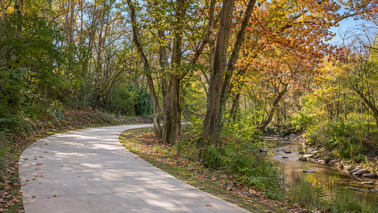
Park at the trailhead at 1793 Briarwood Road NE and head southwest on the paved path. You'll reach North Druid Hills Road in a little over a mile, and the paved path ends there. That stretch is the Model Mile. It opened in December 2019, and it is still the only completed paved section of the Peachtree Creek Greenway in Brookhaven. Urbanize Atlanta described it that way in May 2026.
You'll often see "near the Greenway" in a listing on this side of Brookhaven. The words describe two separate things. One is the mile of trail you can walk the day you close. The other is a regional plan for about 14 miles of trail through Atlanta, Brookhaven, Chamblee, unincorporated DeKalb and Doraville. When a price is built on the second, the buyer is paying now for construction that has no start date yet. The homes near the Greenway that are priced most soundly are the ones that would still be worth the money if the Model Mile were the only trail for several more years.
The mile that exists, and where you get on it
The Peachtree Creek Greenway nonprofit lists three parking trailheads for the paved trail: 2036 North Druid Hills Road, 1801 Corporate Boulevard NE and 1793 Briarwood Road NE. The same page also lists an unpaved 1.5-mile loop at North Fork Creekside and Cheshire Farm near Lindbergh. It isn't connected to the Model Mile yet, and the nonprofit expects it to link up later.
Those three addresses matter when you compare homes. A house a short walk from one of them gets the Greenway today. A house farther down the creek corridor, east of Briarwood or southwest of North Druid Hills, sits near a planned route. Its walk to paved trail is whatever it is now.
West toward Atlanta: funded, with bids due in 2027
Phase II is the piece most buyers have in mind when they talk about the Greenway "connecting." It runs southwest from North Druid Hills Road to the Atlanta city limit, toward Lindbergh and the Beltline. Rough Draft Atlanta reported in May that Phase II is 1.1 miles long and that the final design has seven pedestrian bridges and is mostly boardwalk. On May 13, 2026, the Atlanta Regional Commission awarded $13,593,489 in federal funds for it, and the City of Brookhaven said the project was moving into implementation.
The latest status is in the city manager's departmental report dated October 15, 2026. All right-of-way for Phase II is secured except three parcels, numbers 1, 2 and 10, which are in active condemnation proceedings. The report gives a new letting date of the first quarter of 2027. Building the bridges and boardwalk follows the letting.
The schedule has moved before. A 2022 Rough Draft Atlanta article repeated a forecast of a Phase II groundbreaking in mid-to-late 2024 and possible completion in 2026. Projects like this one move through funding, land and bidding, and each step can add time. If a seller's asking price assumes the Atlanta connection is close, check that assumption against the city's own date.
On the Atlanta side, the City Council approved a $6 million project-management agreement with the PATH Foundation on September 15, 2025, for the regional effort. That agreement supports the larger route. It doesn't open any new trail in Brookhaven.
East toward Clairmont: the route is still being chosen
Phase III would carry the trail east from Briarwood Road to Clairmont Road and the Brookhaven–Chamblee line. In April 2024, Brookhaven declined $1.28 million in federal funds for this phase and said it would use local money to deliver it faster. On January 27, 2026, the council approved a study of another option, a route that crosses the creek to reach Barone Avenue on the east side of the North Fork of Peachtree Creek. That study came after a public meeting in September 2025, and Rough Draft Atlanta reported that the Hendrix and Avana Uptown apartment communities sit in the area the alignment would pass through.
Public Works presented three alternative routes, with costs and recommendations, on August 25, 2026. As of the October 15 report, the city still had to decide whether more public engagement was needed before designing a preferred route. A value-engineering study, estimated at $50,000, is planned for early 2027.
This matters for a buyer on the east side. Until a route is picked, nobody can say which streets near Briarwood and Clairmont will end up beside the trail and which will be a few blocks away. With the route undecided, a listing east of Briarwood that prices in future Greenway frontage is pricing in a guess.
What's planned along the trail
Two large projects sit on the paved part of the Greenway. Both are on the calendar, and both follow schedules of their own.
The first is Northbend, on the former Corporate Square campus. Third & Urban and HighBrook Investors are planning a $605 million mixed-use district there. By Urbanize Atlanta's October 30, 2025 report, Brookhaven had rezoned the site and the developers had closed on it. The first phase as reported has 390 apartments, 23 rental townhomes, 119 for-sale townhomes, 140 corporate-housing units, 10,000 square feet of retail and a one-acre public plaza. The developers' schedule then targeted first deliveries in 2028. In the city's September activity report, "Corporate Square-Northbend" at 54 Corporate Square appeared under land-disturbance review.
The second is the Nalley BMW redevelopment on North Druid Hills Road with Asbury Automotive Group. The city approved the project at more than $150 million. The City of Brookhaven's description includes direct connections to the Greenway, an $8 million investment in the Greenway corridor and a parcel held for a future hotel. In late summer, the Atlanta Business Chronicle reported that site acquisition was complete and environmental remediation was underway. The former hotel and an office building on the site are to be removed by early 2027, before site development begins.
Both projects will add people, connections and activity around the Model Mile over the next several years. Neither adds a mile of trail. For a nearby homeowner, they will change what's around the existing trail more than how far you can walk on it.
How the 7% projection was built
One number tends to come up when people talk about Greenway value. Peachtree Creek Greenway Inc., the nonprofit behind the trail, commissioned an economic impact study from KB Advisory Group, and Urbanize Atlanta reported that the analysis covered a half-mile buffer on either side of the proposed route. Rough Draft Atlanta reported in May 2025 that the study projected a 7% rise in property values along the trail, about $159 million, plus $7.1 million in new property-tax revenue within 10 years of full buildout.
That 10-year window starts at full buildout, after the whole regional route is finished, and it covers the whole planned corridor. Today Brookhaven has one finished paved mile, a western link with bids due in 2027, and an eastern route that hasn't been chosen. Full buildout is several construction seasons away.
For a buyer, part of that projected gain may be in some asking prices already. A seller who prices in the whole 7% is asking you to pay today for value the study expects a decade after a finish date nobody has set. You'll do better to pay for what you can see from the driveway. If the extensions arrive, treat that as a bonus.
Reading a listing that says "near the Greenway"
That leaves three practical questions to ask of any home along this corridor.
First, which trailhead is closest, and how do you actually get there on foot? The three listed parking trailheads are the fixed points. A home's walk to Briarwood Road, Corporate Boulevard or North Druid Hills Road is something you can measure today.
Second, which side of the Model Mile is the home on? Southwest of North Druid Hills, the value depends on Phase II and its 2027 letting date. East of Briarwood, it depends on Phase III, which still needs a chosen route and a value-engineering study in early 2027.
Third, how close is the home to Northbend or the Nalley site? That decides whether you'll live next to a few years of construction before the new public spaces open. We go through the same trade-offs on attached and detached homes in our look at townhome and single-family living in Brookhaven. For the trail the Greenway is meant to reach, see our Beltline loop post.
Quick answers
Can I walk or bike from Brookhaven to the Beltline on the Greenway right now?
No. The paved trail in Brookhaven runs between North Druid Hills Road and Briarwood Road. Phase II, the section toward the Atlanta city limit, has a letting date in the first quarter of 2027, per the city's October 15, 2026 report.
Will the Greenway reach Chamblee?
Phase III is planned to run to Clairmont Road at the Brookhaven–Chamblee line, and the regional study maps extensions beyond that toward Chamblee-area segments. As of October, Brookhaven was still choosing among three Phase III routes. Our Chamblee neighborhood page covers that side of the line.
Will Northbend have homes for sale?
The first phase as reported in October 2025 includes 119 for-sale townhomes, with first deliveries targeted for 2028.
If you're weighing a home near Briarwood Road or North Druid Hills Road, we're glad to walk the trailheads with you and compare each address with what's actually open and what's still scheduled. If you already own near the Greenway and want to know how buyers are likely to price that today, start with an instant home valuation, then reach out to Erin Olivier for a Brookhaven read that accounts for the trail.